Work Party schedule continues on 4th Saturday each month

The trails work party schedule for the coming months remains on the 4th Saturday of each month.

Most recently, work has focused on the Springridge Road/Gazzam Lake trail re-route – moving the existing trail onto public land. Lots of help from the BHS Gear Grinders and Cross-Country teams on this trail. It is now open, and you’re encourage to use it, not the old trail. (And please stop removing the material we’re using to block the old trail!)

Upcoming work parties – next one is scheduled for Grand Forest West – that’s our February event. This is expected to be a cleanup of winter damage.

Posted in Uncategorized | Comments Off on Work Party schedule continues on 4th Saturday each month

on Hawley Cove trail routing

Hawley Cove Park is small, and may not be well-known – but is one of the few public accesses to the north shore of Eagle Harbor. It has been the subject of planning for a number of years, and as planning has proceeded some outdated and/or incorrect information has been published in an attempt to influence the decision-making process.

The following is a summary of more recent information that has affected the planning and decision-making process, at least at the Trails Advisory Committee level.

  1. Attempts to bisect the park by adding a second upper trail for a “commuter route” increase the disturbance area, not lessen it. The proposed “upper trail”  is longer, wider, and thus more expensive to build.
  2. Any wetland impact is greater for a commuter trail due to the wider standard and the distance required to cross the wetland and buffer, compared to the distance to cross and connect to the existing berm.
  3. Recent evaluation by the RCO grant committee had the following comments on the use of this property as a commuter route:
    1. the maximum width we proposed was 6 feet – they felt that such a trail was too narrow for a safe bidirectional commuter route.
    2. The Wing Point neighborhood does not provide enough “service”  to compete well with other grant applications which were serving as links to major populations of potential commuters.
    3. The grant committee liked the trail, but suggested that it be moved to the local parks category as a recreational trail with accessible beach access. Parks Board decided not to move into that category because of another project that they wanted to complete in that category (the dock in the park off Hidden Cove Road I think it was);
    4. The routing of the trail was NOT a factor in their decision – the committee simply thought that not enough people were served by this trail to compete in that category.
  4. The time savings by changing to the more direct route is measured in seconds on bicycle and less than a minute on foot. A route change does not save people even several minutes to the ferry.
  5. The City again has plans to improve Wing Point Way for safer use by commuters.
  6. Have you ever hiked or biked up Hawley Way? Its steep.
  7. Lighting would not be installed in the park, minimizing its use in winter months. Wing Point Way at least has street lights.
  8. The existing trail and boardwalk will be adjusted and rebuilt, to make it more accommodating and safer for multiple user groups.
  9. The District focuses on recreational trails and allows NM use of them for commuting or transportation, but the design and implementation is not driven by the NM standards . The Class 1 standard (8 foot width) is utilized where we connect to a NM route.  We have never changed trail routing to a direct or straight path anywhere I am aware of or allowed our trails to be widened to a NM standard.
  10. A letter from one of the previous owners, their wish for the site was to maintain the conservation value of the park for beach access and environmental education.
  11. We’ve heard concerns from the lower neighborhood about the possible impact of heavy commuter usage.
  12. The construction technique planned, combined with the smaller boardwalk (in length and width), will minimize impact on the salt marsh, and should provide a special experience for all users.

All in all, we think the proposed route is good, fiscally and environmentally responsible, and will be a pleasant experience for all users.  Visit the park yourself.


Posted in editorial | Tagged , , | Comments Off on on Hawley Cove trail routing

Blakely Harbor Trails update

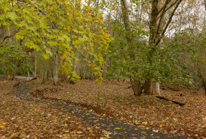
the trails around Blakely Harbor have been getting a substantial upgrade, the culmination of a long planning process. One of the goals has been to close off any trails that have made it into the tidal marsh area. Here we see where the new trail replaces a boggy portion of the old trail.

rgg-20141122-115239

Part of the work has involved ivy and other invasive vegetation removal, along with a thick mulch cover  – which has proven effective in nearby areas.

rgg-20141122-120514

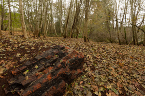
There’s are a few reminders of the previous century, when this place was the largest lumber mill in the Western US.

rgg-20141122-120600

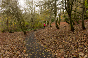
Although there are some areas still under construction, the trail system remains usable.

rgg-20141122-120756

Posted in News | Comments Off on Blakely Harbor Trails update

October 2014 Work Party

The monthly work party will be on the Veterane-Gazzam Lake trail. This is a new trail, replacing an unsustainable rogue trail that drifted onto private property.

Meet at the Veterane trail head, west slope of Baker Hill Road, at 10 AM.

Posted in News | Comments Off on October 2014 Work Party

The 2014 Comprehensive Plan and Trails

There has been a bit of misleading information out there regarding on-Island trail development published lately. Some of this can be attributed to misleading and incomplete articles published in local news sources and online forums. I would encourage anyone with concerns about local trail planning and development – do a little more research and reach out to the people involved.

Here’s one source that may serve to address recently-raised questions.

The Bainbridge Island Metropolitan Parks and Recreation District (hereafter BIMPRD or simply ‘Parks’) published an update to its Comprehensive Plan this year, and it has quite a lot to say about trail planning and development. It even has an entire chapter  (chapter 4) designated as a “Trails Vision Plan”.

You can find links to each document section here: http://www.biparks.org/aboutus/public_meetings.html

I’d like to call out a few sections: http://www.biparks.org/aboutus/documents/comp_plan2014/chap1-chap3.pdf on page 33, in the section entitled ‘Off-Road Trail Systems’ states as goals:

  • Create a comprehensive system of trails appropriate to hike, bike, equestrian experiences that access scenic, environmental, historical, and open space attributes on the island, and expand and link the existing trail systems to create island-wide networks.
  • Develop a series of trailheads, trailside rest stops, viewpoints, interpretive exhibits, and trail signage systems that integrate hike, bike, and horse trails with specific historical, cultural, environmental, and scenic points of interest , such as former boat landings, sawmills, farmsteads, roads, and bridges, among others.
  • Where appropriate, complement continuous trail corridors and/or loop routes with parks, other public facilities, historical sites, and the Winslow urban center, and link to COBI’s non-motorized plan.
  • Furnish trails with appropriate supporting trailhead improvements where appropriate that include interpretive and directory signage systems, rest stops, restrooms, parking and loading areas, water, and other services.
  • Where appropriate, link to trailheads at or in conjunction with park sites, and other community facilities to increase local area access to island-wide trail systems and reduce duplication of supporting improvements.
  • Develop trail improvements of a design and development standard that is easy to maintain and access by maintenance, security, and other appropriate personnel, equipment, and vehicles.
  • Develop and support a Trails Committee and support volunteer Adopt-A-Trail programs for citizens and organizations to provide park maintenance and litter pick-up activities

In the next component is the Trails Vision Plan: http://www.biparks.org/aboutus/documents/comp_plan2014/chap4.pdf, where on page 17  is listed the Goals, which are to:

  • Enhance the community’s use of District’s resources by expanding recreational use of District trails.
  • Provide safe trails that protect and conserve the natural landscape.
  • Provide for community connections to our unique history, landscapes and natural beauty.
  • Promote health and wellness for community members with natural trails for hiking, jogging and experiencing nature.
  • Increase community connections between the Winslow core, parks, recreation centers, schools and neighborhoods by linking to other publicly maintained non-motorized corridors.
  • Integrate park trails into an island – wide transportation system which connects the island both north and south, and east and west.
  • Coordinate with and compliment the City of Bainbridge Island (COBI) Non-Motorized Transportation Plan (NMTP) for trails not in right-of-ways.
  • Develop a trail classification system that meets the needs of a large variety of user types and abilities.

On the following page, there is a description of priorities, with this qualification:

Specific trail priorities will be set by the BIMPRD Board of Commissioners , generally during the annual budget development process, with the possibility of adjustments during the course of the year.
The District will focus its limited trail resources on the priorities established by the BIMPRD Board annually. Trail priorities are subject to change and may include the following:

The priorities are then listed as follows:

  • Trails between parks (e.g. Forest to Sky Trail).
  • Trails within parks (e.g. Grand Forest Trails).
  • Trails that lead to points of interest, such as shoreline access or viewpoints.
  • Cross-island trails (East/West, North/South) independent of the NMTP Core 40.
  • Develop a series of trailheads, trailside rest stops, viewpoints, interpretive exhibits, and trail signage systems that integrate hike, bike, and horse trails with specific historical, cultural, environmental, and scenic points of interest – such as former boat landings, fish traps, sawmills, farmsteads, roads, and bridges, among others.
  • Trails linking parks to COBI’s NMTP Core 40 corridor.
  • Develop trail improvements of a design and development standard that is easy to maintain and access by maintenance, security, and other appropriate personnel, equipment, and vehicles.
  • Develop and support an Adopt-A-Trail program for citizens and organizations to assist with trail maintenance activities.
  • Development of an island-circumnavigating water trail. The trail may incorporate and improve a system of boat ramps, landings, and other improvements to public facilities for appropriate non – motorized watercraft. The water trail may be incorporated as an extension of the Cascade Marine Trail, which traverses from Canada to the southern reaches of Puget Sound

Finally, in the ‘Acknowledgements’ section are these statements:

  • The Park District acknowledges COBI as the lead agency for development and maintenance of road ends and on-road pedestrian and bicycle touring routes, and scenic drives.
  • The Park District will partner with public, private, and non-profit entities when available and applicable to develop and maintain an integrated system of trails on Bainbridge Island, such as the Sound to Olympics trail, NKTA’s String of Pearls, and COBI’s Non-Motorized Transportation Plan including the Core 40 Plan.

After reading all of that, and reviewing the planning maps, I think you’ll find that the Parks District is working both to maintain and improve the trail network for all users, and when appropriate working with the other agencies to enhance overall trails connectivity. I’ve served as a volunteer with the Trails Advisory Committee for many years, and I can honestly say that trail connectivity has always been one of many considerations in the development of new trails.

And don’t forget: the Trails Advisory Committee meets at Battle Point Park on the 2nd Monday of each month (7 pm). Work parties vary by location but are always 4th Saturday of each month, 10 AM.

 

Posted in editorial | Tagged , , | Comments Off on The 2014 Comprehensive Plan and Trails

Undergoing Changes

This site has been languishing for content recently, but I can say that we continue to work on the Veterane Trail (off of Baker Hill Road) and there are several projects in the Gazzam Lake area in the pipeline for construction.  For this month (August) we’ll be at Veterane on the 4th Saturday.

Posted in Uncategorized | Comments Off on Undergoing Changes

New Trail Maps and Signs

The Bainbridge Island Metro Park and Recreation District has been working on new trail maps and signage in an effort to make all trail users, both experienced and inexperienced, comfortable using our wonderful trails. The project began with Gazzam where the map has been posted at the kiosks at Deerpath and Marshall Rd parking areas. The maps show way points along the trail and as you walk the trail you can check your location, making it simple for folks less familiar with the trail to find their way around the entire trail system.

We will begin removing the old signs which we received mixed reviews about. The new signs should look familiar to trail enthusiasts because they are the same kind of signage we have all seen in our National Parks and Forest Service trail systems. They are relatively inexpensive, easily maintained, and very flexible in their application of communicating way-finding information.

The Grand Forest West has just finished being installed as well. We are installing the signs on Hilltop Trail and into the Grand Forest East with the Grand Forest East maps on order, to be installed by May 1. The next trail system to get a map and signs will be the Hidden Cove trails where we receive many comments regarding way-finding issues.

For copies of the Gazzam and GFW maps you can receive a hard copy from the office at Strawberry Hill Park or online at biparks.org. Just go to the Park and Facilities tab, click on trails, go to Gazzam or the Grand Forest and you can see and print the map for yourself. As we add maps they will become available on the website.

The other way to receive the map is by using your smart phone. We have QR codes on the maps at the site and will be installing QR codes on the signs as well soon. It is our intention to make your visit on our trails as pleasant as possible and we hope these new maps and signs enhance all users experience while on the trail.

Thanks,

Dan Hamlin
BIMPRD Park Services Superintendent

Posted in News | Comments Off on New Trail Maps and Signs

March TAC Work Party

Hi all,

Work is continuing on the Ft Ward Ridge trail. This trail is going to be a very nice addition to the Ft Ward trail system. Once complete it will connect to the Ft Ward Blakely trail and provide scenic views of the water from high up on the ridge.

You can join the fun by meeting at the upper parkign lot at Ft Ward Park at 10am this Saturday March 23rd. Erik Sherwin will lead the group down to the work site. We hope to have this trail complete
within a few months.

The Park District will provide an assortment of tools. Please bring a snack, gloves, appropriate clothing, and help us with this project.

For questions contact Erik Sherwin at 206-245-7382 or erik@biparks.org.

Posted in News | Comments Off on March TAC Work Party

January TAC Work Party

Hi all,

We are beginning construction of a new trail at Ft Ward Park tommorrow, Jan 26. If you would like to join us we will be meeting at 10am in the upper Ft Ward Park parking lot. The work party will be held from 10am to 1pm. Bring a snack, gloves and your favorite trail tool. Work will consist of moving ferns and trimming debris from the new trail corridor.

It is important to arrive by 10am in order to follow the group into the woods where the construction will begin. For questions contact Erik Sherwin.

Posted in News | Comments Off on January TAC Work Party

GO! Bainbridge

GO! Bainbridge, a program of Sustainable Bainbridge, is starting a series of winter walks, nicknamed Poncho Walks. They will run on the first Sunday of each month, November thru March with a goal of helping people stay physically active all year – rain or shine!

On Sunday, November 4, we will leave from the Bainbridge Island Library at 1:30pm. With the guidance of veteran walker and Strider member, Jean Otto, we will follow sidewalks and paths through Winslow. A highlight of the walk will be the visit to Middle Field Farm off of Weaver Road. Larry Nakata will meet us and talk about the history of the farm and its current uses providing local produce to their family’s Town and Country Market.

The walk is about 4 miles in length and will end with hot beverages at the library and a display of maps showing current and proposed trails. Chair of the Non-Motorized Transportation Committee, John Grinter, will be available to answer questions.

As there is always a chance of rain, wearing sturdy shoes and bringing a poncho or other waterproof clothing is advised.

Posted in News | Comments Off on GO! Bainbridge